18: Kinlochleven to Fort William

At just over 16 miles and with over two thousand feet of elevation gain, today's walk is one of the longer days of our itinerary. It also probably everyone's last day as there's no possibility of breaking the journey and yesterday's itinerary from Kingshouse to Kinlochleven also had no obvious rest stop for those without a tent.  

In terrible conditions it is possible to shorten the route by taking the military road as it forks beside the ruins of the old toll house above Lundavra. This route leads more directly to Fort William and shaves three miles from the journey, but that would mean missing out on Glen Nevis and (if we are lucky) a view of Scotland's mightiest mountain.

The pipes for the hydro-electric power station snake down the mountain behind Kinlochleven


The Way climbed rapidly out of the town and over a mile we scaled seven hundred feet. Soon we have a view over the Loch and back to the town.  Carrying on, we walked along the Lairigmor, or the Big Pass, used for hundreds of years by cattle drovers.

Jerome on the Lairigmor

The track is raised above the valley bottom, dry and metalled with small stones and broken rocks. This had been the norm for most of the Way and it was very hard on our feet. The valley itself is between two ridges, the Mamores to the north and the Mam na Gualainn circuit to the south. Having spent the whole journey seemingly in a valley, the ridge walk to the south looked very tempting indeed. For experienced walkers the Mam na Gualainn circuit takes about seven to eight hours to complete. To add it onto our route would have meant an additional three miles of walking and a couple of thousand feet of climbing. 

Another alternative would have been to climb over the Mamores. This would be an even bigger challenge but a very exciting one and looking at the OS map I can see several possible routes for heroes using some of the paths of the 'Ring of Steall' as it is known. 

The valley was easy in comparison. The way was so peppered with hikers that it would be a challenge to get lost and indeed along the whole route way-marking is excellent. We could have walked the whole distance of the West Highland Way without referring to a map. Not that I recommend that you do. 

Also, for those people relying on their mobile phones, the signal was patchy at best and quite often there was none at all. Occassionally in the valleys the GPS signal could be compromised. So it is important to download any maps whenever possible to route-find offline and when walking keep a careful eye on your position, so that it is possible to retrace your steps should you get lost.

The Way carried on eastward for six miles before turning north, still in the valley. Within a mile the path entered a scrubby remnant of Caledonian forest.

A scrubby bit of Caledonian forest


In amongst this was a cairn that commemorates a skirmish from the Civil War of 1645. It marks the spot where in the aftermath of the battle of Inverlochy, the MacDonalds of the Montrose Army (and basically Royalists) gave up chasing the rump of the defeated Covenanter (basically Parliamentarian) Argyll forces (some of whom were Campbells). 

Less than a mile further on we arrived at the ruins of Blár a´Chaorainn toll house, the half way point of today's walk and where if the weather is bad the military road that forks off to the left offers a quick route to Fort William.

Lochan Lúnn-Dá-Bhrá and Lundavra farm


To the east is Lundavra farm and Lochan Lúnn-Dá-Bhrá where a mythical water bull is supposed to occassionally emerge and kill the local cattle. It is also thought to be a place where the Scottish King MacBeth lived, but this might also be mythical water bull as well because there is no supporting evidence for this claim. 


Did I mention that there were one or two other people on the route?


The Way which had been heading north, meandered eastward and straight ahead the massif of Ben Nevis filled the head of the glen. 
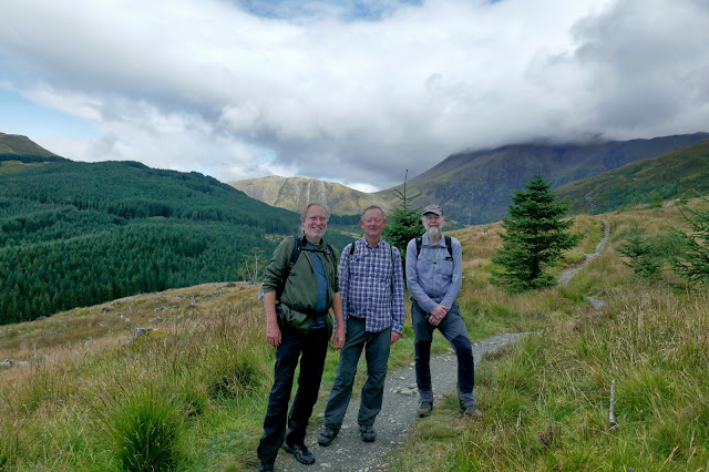
That big lump of cloud is Ben Nevis


We settled down for a lunch of fruit and biscuits, some of which we'd bought from the Coop in Kinlochleven. This path was only one person wide and a little rougher than the military road. Over a couple of miles it contoured around to enter Glen Nevis under the old vitrified fort of Dun Deardail. Originally built nearly two and a half thousand years ago it has an excellent position, commanding the Glen opposite Ben Nevis. The fort was burnt down around 350 BC which caused the vitrification of some of the stone. Apparently this was the fate of a number of similar aged forts but almost nothing is known about the people who lived here.

Ben Nevis loomed impressively ahead of us, the cloud thinning and fleetingly teasing us with a tantalising view of the scree scattered summit.

A tantalising view of the summit

Now, the path descended rapidly into the Glen, revealing the massive bulk of Ben Nevis (yet another caldera volcano) dwarfing the surrounding mountains.

At this point I made a mistake in following the route all the way to the road. It is possible (and quicker) to keep above the road following the signs to 'Braveheart Car Park'. This is marked as an alternative route on the map - but the main route for some bizarre reason is along the road. Once we had got down there were so many people walking on the pavement that I suggested we cut across and head back to the alternative route. Jerome was a bit reluctant and I have to admit I didn't understand why he would want to stay on the road. Later he admitted his feet were finding the metalled surface hard going and he would have appreciated the softer pavement. 

Our route curved into Fort William arriving above the town, then snaking through backstreets until we came to a sign.   


Sitting on a bench beside it was our photographer from the first day. We did not plan this. We hadn't seen her since the Glencoe mountain resort but here she was.


Cary flanked by Chris and Jerome

And we finally found out her name as well.  


Jerome, Chris and Duncan and where we are headed next (background)

So we had completed the West Highland Way in seven days and in that time the sun had shone brightly and we had experienced less than an hour and half of rain. 

It was never too hard for us, even on the longest days. The climbs were gentle. The descents didn't hurt the knees. Even the Devil's Staircase was not really difficult, as its name derived from the tragedies of a century or more ago.  

The hardest part of the walk without doubt was the path itself. The rocky, stony metalled surface was punishing on the feet and I would recommend that only the sturdiest of soles can offer any protection from the constant onslaught. 

Jerome enjoyed it more than he had hoped, whereas Chris and I were slightly disappointed it was over so quickly. On the Pennine way were walking into Horton-on-Ribblesdale after roughly 97 miles and still had more than half of the distance to go. We would have happily continued and for those who want further adventure the Fort William to Cape Wrath trail offers over two hundred miles of the most challenging walking in the UK. Be advised though that there will rarely be hostelries at the end of a day, no coffee wagons and very little in the way of company. Food and shelter will need to be carried.

Fortunately we had booked an apartment and tomorrow, weather permitting, we'll climb Ben Nevis and hope that when we arrive on the summit for a short moment the clouds will part and allow a view. 

Before that we made the short pilgrimage into the Black Isle Bar for a pint (or two) and pizza.

Comments

Popular posts from this blog

6: A famous hostelry in Drymen (Glengoyne to Drymen)

Drymen, where we are headed this evening isn’t pronounced how you might expect. This is one of those quirks that quickly becomes normal in Scotland.   When the locals say Drymen it rhymes with women or swimmin’,  keeping  the emphasis on the beginning of the word and it is said with pace, there’s no lingering over the syllables. So our attempt, which was basically looking at the word and saying what saw ie ‘Dry - men’ was wrong on just about every level.   Leaving the Glengoyne distillery we were walking on an easy path across a flat plain. However we were by this stage becoming aware of the vast numbers of fellow walkers and began to worry about the meal options for the evening. Chris looked online at the various hostelries and decided that he liked the look of one in particular so he booked a table. The hills continued to offer an enticing prospect to our right but the path ignored their siren call. Very quickly we arrived at a road and beside it, handily placed for a lunchtime stop

5: A drop of the good stuff (Milngavie to Glengoyne distillery)

In our opinion the first day of any long distance walk should not be too challenging. Others will race off with a heroic distance to be covered and good luck to them. Experience has told us that we do better if we ease ourselves into the rhythm of a walk with a relatively straightforward day.    The self luggage transfer service (£1 - cash only) never really got off the ground. The West Highland Way is very accommodating by having a variety of conveniently placed staging posts. Drymen, where we are headed at just under fourteen miles is the resting place for those similarly minded to enjoy a comfortable first day. Others, whose ambitions are for a faster and more challenging trek will head to Balmaha, nearly nine miles further on and with an additional thousand feet of ascent.   A hardy few will carry on up the side of Loch Lomond, perhaps to Rowardennan, adding another six or so miles to their day. The way out of Milngavie snaked past the back of industrial estates and houses before w

15: A Slight Diversion

Meet the Jacobites (with a bit of the tragic history of Glencoe) Jacobite hopes Public domain, via Wikimedia Commons This is a really complicated part of the history of the British Isles and although I'm paraphrasing madly here, there's quite a bit to plough through in order to get some understanding of the Jacobites and why the massacre at Glencoe was so significant.  King Henry the VIII gets a pretty bad press these days for his treatment of women. What tends to be forgotten is that he was, almost exclusively, the architect of some of the most divisive royal, religious and political events witnessed in these Isles for over two hundred years after his death.    Portrait of a young King Henry VIII circa 1515-20 Anglesey Abbey He was a second son and as a youngster he was well educated. Unlike Arthur, the first son who was destined to be King and thus was deemed to be infallible and therefore not in need of an education. Then fate lent a hand and Henry became King at the age of